Drone Photography For Construction
Construction Drone Photography and Progress Monitoring in Florida
Drone Genius provides professional aerial documentation for construction projects throughout Florida. Our FAA-certified pilots deliver high-resolution photography, videography, orthomosaic mapping, and progress monitoring that keeps stakeholders informed, supports project management decisions, and creates a permanent visual record of every phase of construction.
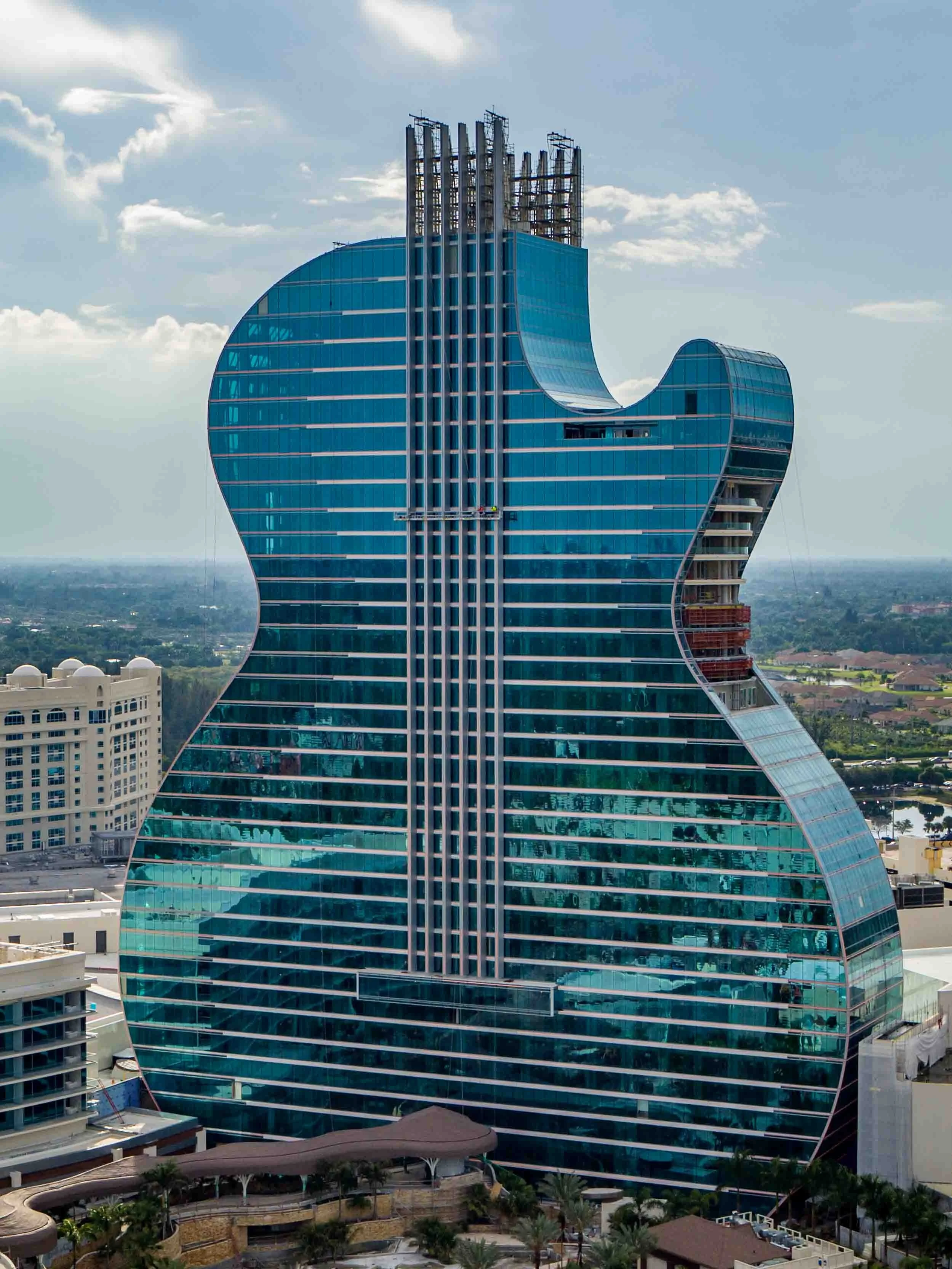
From ground-breaking through final completion, our construction drone services give general contractors, developers, architects, and project owners the aerial perspective they need to track progress, identify potential issues early, and communicate effectively with investors, lenders, and regulatory agencies.
Construction Drone Services We Offer
Progress Monitoring and Documentation
Regular aerial documentation captures your construction site from consistent vantage points at scheduled intervals throughout the project timeline. Weekly, biweekly, or monthly flights create a visual timeline that tracks progress against milestones, documents site conditions, and provides stakeholders with clear evidence of advancement. Our progress reports include dated, geo-tagged imagery organized for easy comparison across time periods.
Orthomosaic Mapping and Site Surveys
High-resolution orthomosaic maps stitch together hundreds of overlapping aerial images to create dimensionally accurate, measurable site maps. These georeferenced maps support earthwork volume calculations, grading verification, site planning, and as-built comparisons. Our mapping deliverables integrate directly with CAD and GIS platforms used by engineers and project managers.
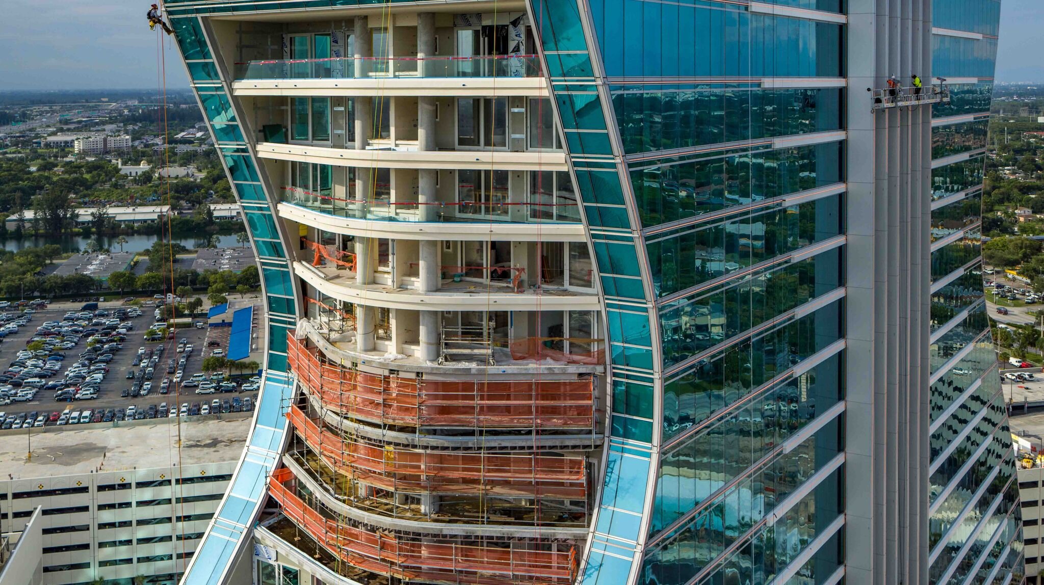
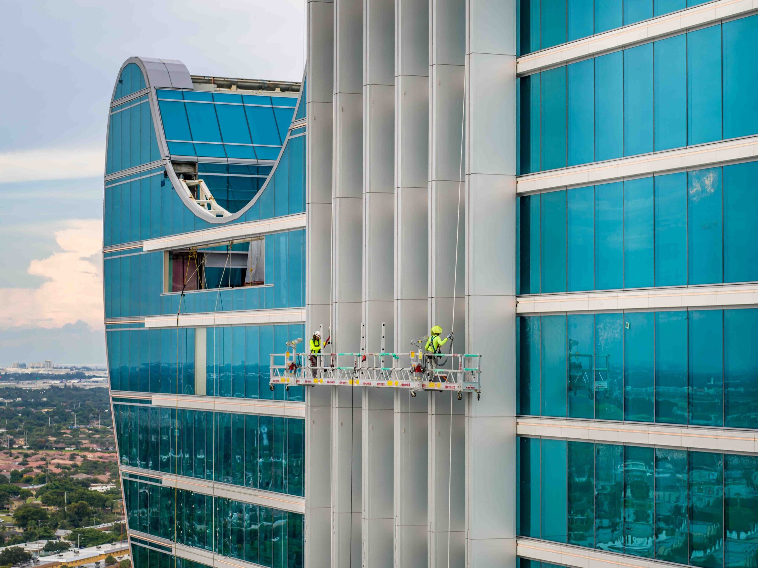
Building and Roof Inspections
Aerial inspections eliminate the need for scaffolding, bucket trucks, and personnel working at height. Our drones capture detailed imagery of roofing systems, building envelopes, facades, and structural elements from angles that are difficult or dangerous to reach on foot. Inspection deliverables include annotated photo reports that document conditions and flag areas requiring attention.
Stakeholder Reporting and Marketing
Professional aerial photography and video give developers and general contractors compelling visual content for investor updates, lender draw requests, board presentations, and project marketing. Our deliverables are presentation-ready and formatted for use in reports, websites, and social media channels that showcase project progress and quality.
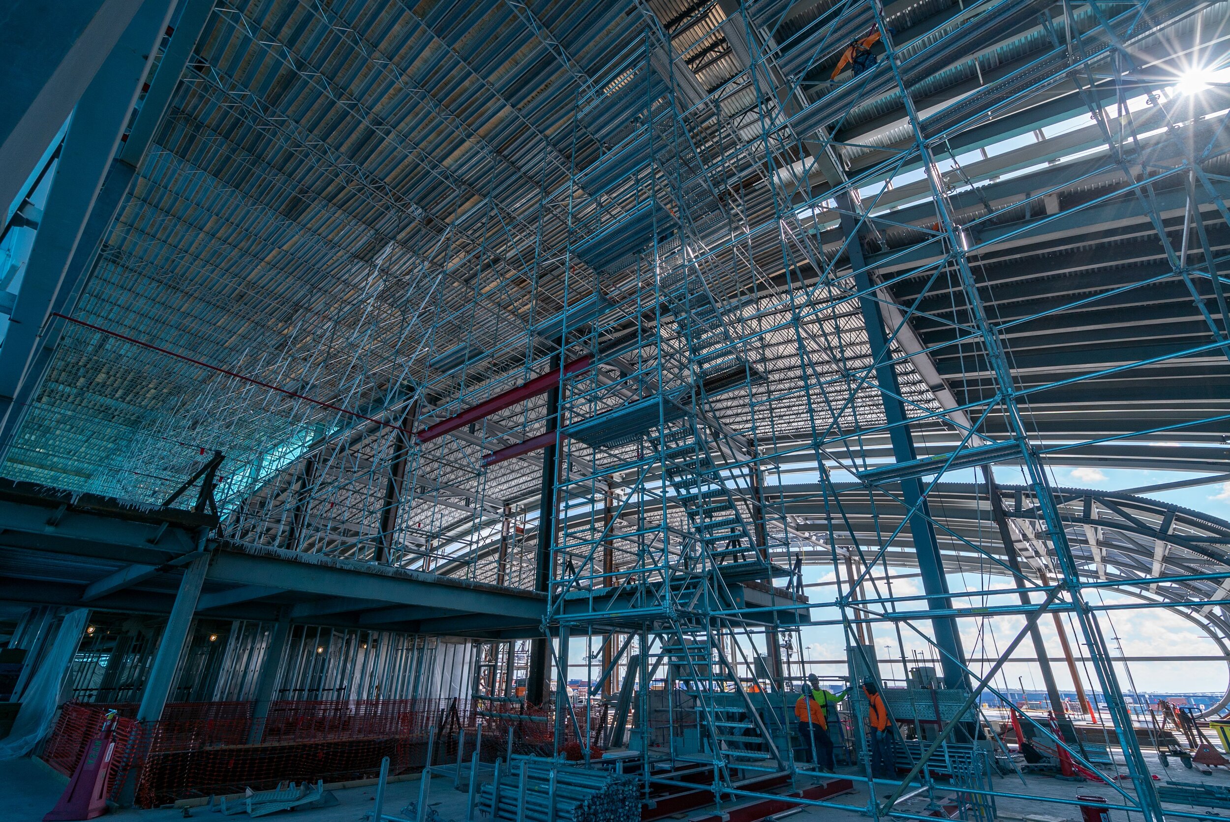
Bridge and Infrastructure Documentation
Infrastructure projects including bridges, roadways, utilities, and marine structures benefit from aerial perspectives that capture the full scope of work. Our pilots document structural conditions, construction staging, and progress across large-footprint projects that are difficult to photograph comprehensively from ground level.
FPV Construction Walkthroughs
First-person-view drone flights create immersive video walkthroughs of construction sites that take viewers through structures, around building perimeters, and across active work zones. FPV footage is ideal for virtual site tours, safety documentation, and marketing content that showcases the scale and complexity of your project.
Why Construction Companies Choose Drone Genius
FAA-Certified and Fully Insured: All pilots hold current Part 107 certifications and carry comprehensive liability insurance. We coordinate with local authorities and file airspace authorizations for every flight near controlled airspace.
Consistent and Reliable Scheduling: Construction documentation depends on regular, on-time flights. We maintain dedicated scheduling for recurring clients and adjust for weather delays without disrupting your project reporting timeline.
Professional-Grade Equipment: We fly DJI and custom-built platforms equipped with high-resolution cameras, RTK GPS for mapping accuracy, and thermal sensors for specialized inspections. All equipment is maintained and calibrated for consistent results.
Fast Turnaround: Standard delivery is 48 to 72 hours for edited photos and video. Rush delivery within 24 hours is available for time-sensitive draw requests, presentations, and regulatory submissions.
Experience Across Project Types: From single-family residential builds to high-rise towers, mixed-use developments, and horizontal infrastructure, Drone Genius has documented construction projects of every scale and complexity across South Florida and beyond.
Industries We Serve
Drone Genius provides construction drone services for general contractors, developers, property owners, architects, engineers, government agencies, insurance companies, and project management firms. Our clients include teams working on residential communities, commercial office buildings, hospitality developments, healthcare facilities, educational institutions, industrial warehouses, and public infrastructure projects throughout Florida.
Frequently Asked Questions
How often should construction progress photos be taken?
Most clients schedule flights weekly or biweekly during active construction phases. Monthly flights work well for longer-timeline projects or phases with slower visible progress. We customize the schedule based on your reporting needs, lender requirements, and project milestones.
Can drone data be used for earthwork volume calculations?
Yes. Our orthomosaic mapping and photogrammetry workflows produce accurate elevation models that support cut-and-fill volume calculations, grading verification, and stockpile measurement. Deliverables are compatible with standard civil engineering and surveying software.
Do you need FAA authorization to fly over construction sites?
Many construction sites in Florida fall within controlled airspace, particularly near airports. Drone Genius holds all required FAA authorizations and files LAANC airspace requests for every flight, ensuring full regulatory compliance so your project is never at risk.
What deliverables do you provide for construction documentation?
Standard deliverables include high-resolution aerial photographs, edited video, and a dated photo report. For mapping projects, we provide georeferenced orthomosaics, digital elevation models, and point clouds. All files are delivered digitally and organized by date and flight for easy reference.
How does weather affect construction drone flights?
Drone flights require safe weather conditions including adequate visibility, manageable wind speeds, and no precipitation. If weather forces a postponement, we reschedule within the same week at no additional charge to keep your documentation timeline on track.
Ready to add aerial documentation to your construction project? Call Drone Genius today at (786) 292-8220 or contact us online to schedule a consultation and discuss your project requirements.
SERVICES


MEDIA EXAMPLES