

10 Creative Uses for 360 Photography in Real Estate
360 view photography gives a development sales team a way to discuss the surroundings from selected capture positions. The most useful presentation connects those views to a clear project brief, with accurate labels and an explanation of what was photographed.
1. Show captured views in the sales center
An interactive panorama lets a sales representative look around a captured position with a buyer. Plan the viewing screen, controls and scene labels around how the team will use the presentation.
2. Compare requested elevations
Where the agreed capture scope includes multiple elevations, organize them so the team can move between views. Confirm the elevation reference and labels with the project team; do not assume a capture position establishes the finished view from a specific unit.
3. Explore different directions
Use a panorama to discuss waterfront, skyline and neighborhood context in different directions. Explain the capture location and date so the image can be interpreted appropriately.
4. Support remote sales conversations
Share an approved tour link during a call so a buyer and sales representative can discuss the same scene. Confirm whether access is public, restricted or intended only for sales-center use before distributing it.
5. Connect the project website to the tour
A clear project card and descriptive link can take visitors into the interactive experience. Test loading and controls on desktop and mobile instead of relying on a static thumbnail to communicate the whole view.
6. Pair captured photography with renderings
Show the proposed design beside captured surroundings when the project team approves that presentation. Label the rendering and photograph separately. Credit the rendering studio for its visualization and Drone Genius for backplate photography, with authorship verified for each displayed image.
7. Give brokers a consistent reference
Provide approved links and scene descriptions for the brokerage team. Consistent labels help people refer to the same location and capture position during project discussions.
8. Add dated construction context
When separately scoped, repeat photography can document visible changes over time. Keep capture dates clear. A visual progress record is not a certified survey or engineering inspection.
9. Create supporting stills or short previews
Selected views can introduce the full tour in a presentation or approved marketing material. Plan the crops and output formats; a flat social preview should link to the interactive tour rather than imply that every platform supports the same 360 controls.
10. Build a clearer capture brief
Use reference views to agree on required positions, elevations, directions and timing before scheduling. Also define hosting, access, revisions and delivery responsibilities in the scope.
See a real developer-view project
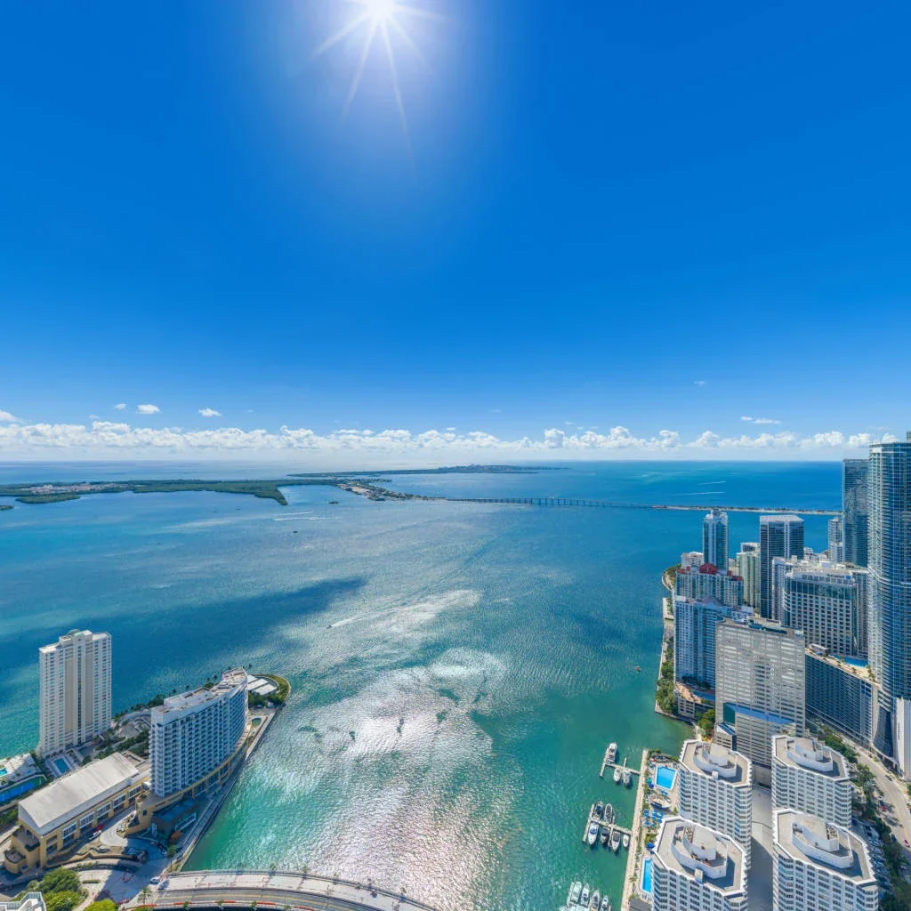
The image above is a captured view from our Nobu Residences work, not an architectural rendering. Explore the Nobu Residences 360 tour and see more developer-view and backplate photography projects.
Captured imagery records conditions at the time of photography. Surrounding construction, vegetation, the finished building and the eventual viewing position may affect a future unit view.
Send the site address, requested elevations, directions and dates to discuss a capture brief with Drone Genius.