Architectural Drone Services for Developers & Design Studios
Professional Aerial Documentation for Architecture Firms, Developers, and Visualization Studios
At Drone Genius, we understand that architectural projects require more than standard aerial photography. Architecture firms and developers need precision backplate capture that integrates seamlessly into rendering pipelines, multi-phase site documentation for design iteration, and production-grade deliverables that meet the exacting standards of the AEC industry.
With over a decade of experience serving South Florida's premier architecture firms and development companies, we've refined our aerial documentation services to support every stage of your project—from initial site surveys and pre-construction visualization to stakeholder presentations and final marketing materials.
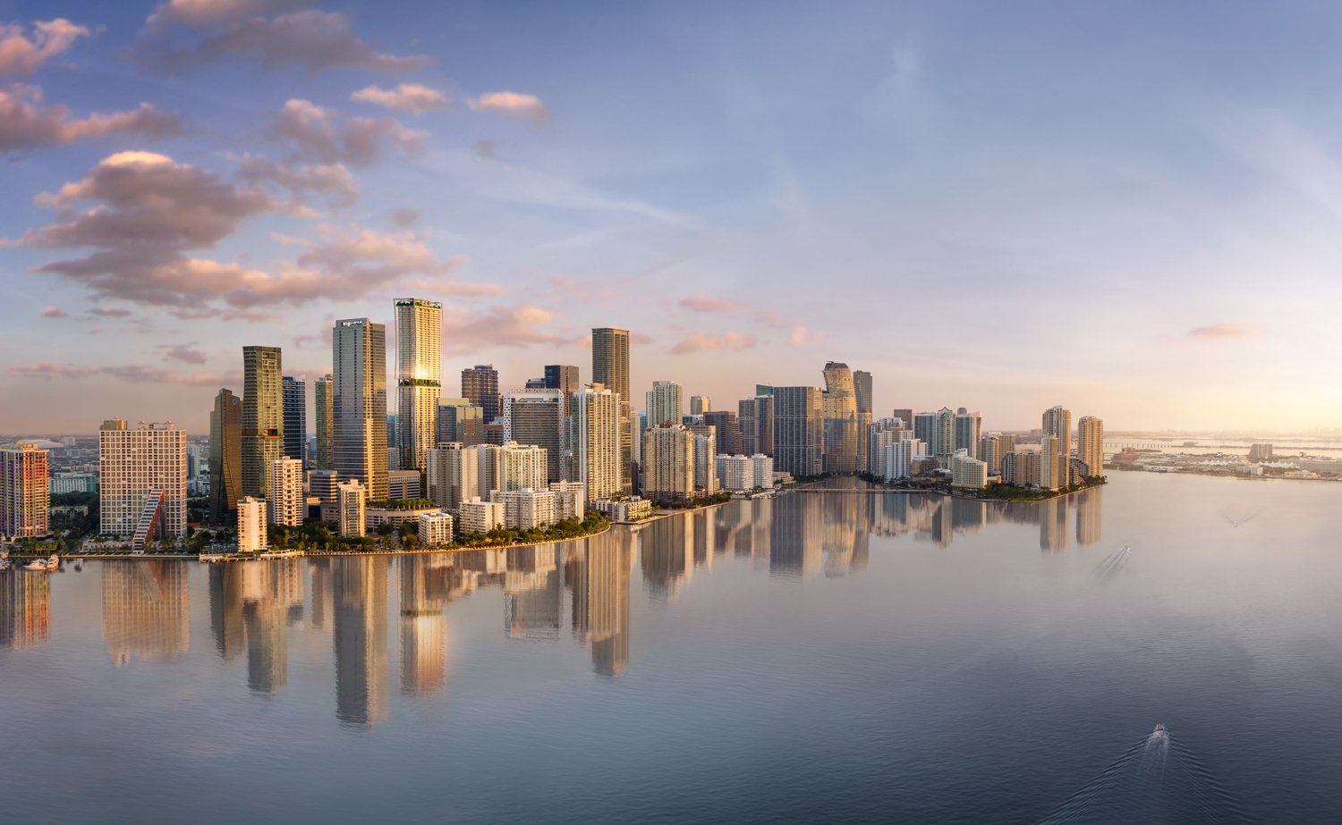
Edition Residences Edgewater
Our Architectural Drone Services
Backplate Capture for Rendering Pipelines
We specialize in capturing high-resolution aerial backplates specifically formatted for architectural rendering workflows. Our team understands the technical requirements of 3D visualization studios, delivering RAW DNG files, precise camera metadata, and consistent exposure values that integrate flawlessly with your rendering software.
What We Deliver:
8K CinemaDNG and ProRes RAW aerial backplates
44MP DNG RAW still photography with 14+ stops of dynamic range
Precise GPS coordinates and altitude data for accurate 3D placement
Multiple viewing angles captured in consistent lighting conditions
Color-graded files ready for compositor integration
Why Architecture Firms Choose Us:
Our pilots work directly with your visualization team to understand exact framing requirements, sun angles, and design intent. We've supported rendering pipelines for major South Florida developments, providing the aerial foundation for award-winning architectural visualizations.
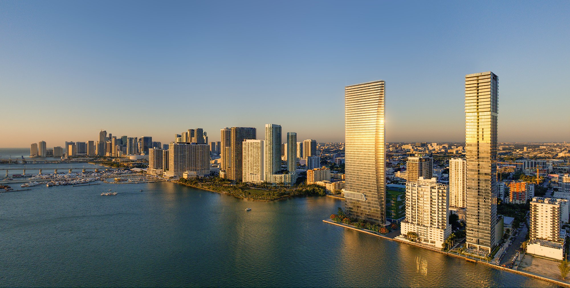
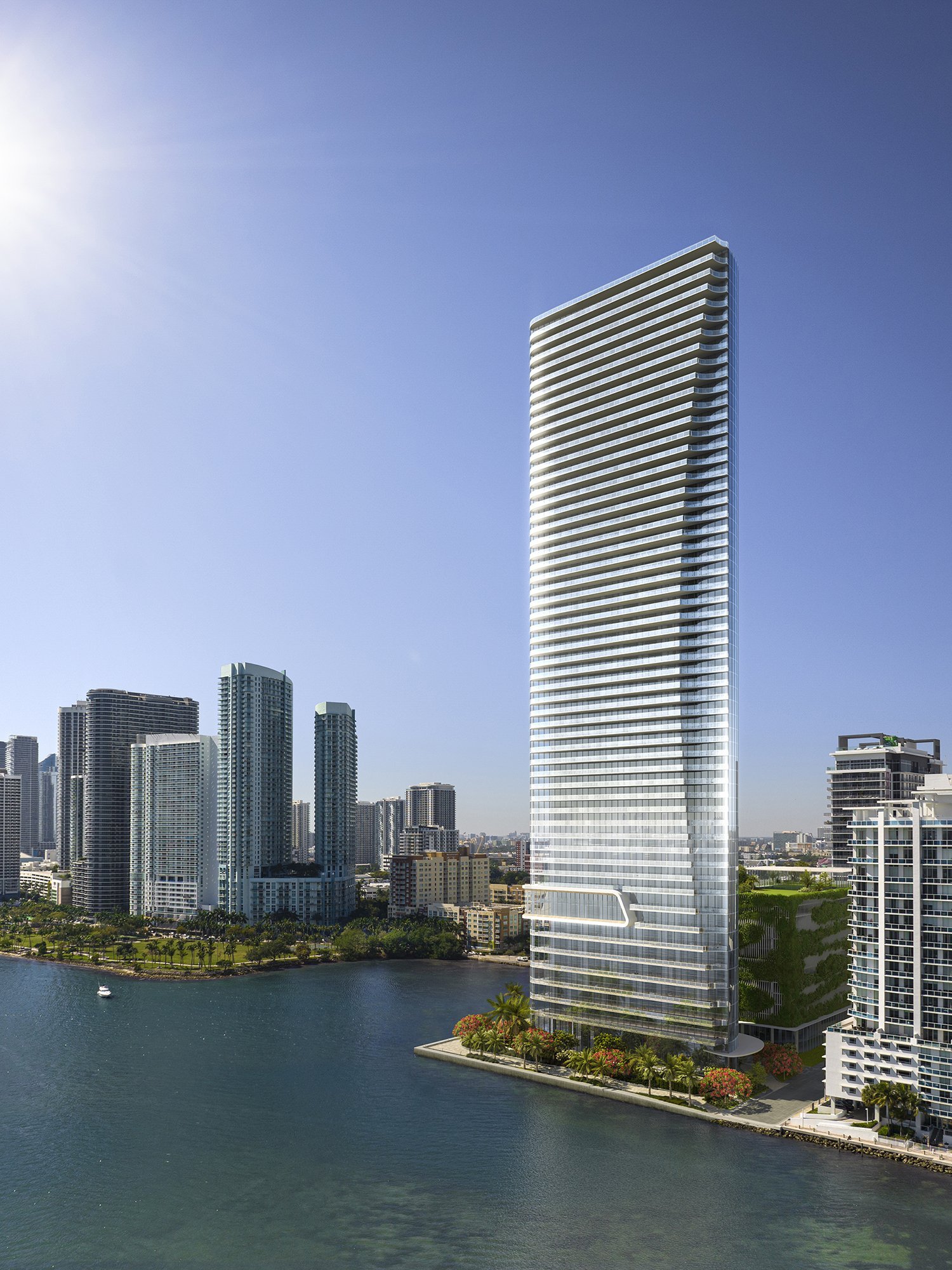
Edition Residences Edgewater
Edition Residences Edgewater
Site Survey Documentation for Design Teams
Comprehensive aerial site documentation gives your design team the contextual intelligence needed for informed decision-making. We capture detailed site conditions, surrounding context, topography, and access points—delivered in formats compatible with your CAD and BIM workflows.
Site Survey Capabilities:
High-resolution orthomosaic mapping for site analysis
Elevation data and topographic modeling
Contextual imagery showing neighboring structures and infrastructure
Traffic flow, parking, and access point documentation
Seasonal and time-of-day variation studies
Applications:
Pre-design site analysis and feasibility studies
Design development iteration and massing studies
Presentation materials for planning boards and community stakeholders
Environmental impact documentation
As-built verification and construction progress tracking

Ora by Casa Tua

Ora by Casa Tua
Pre-Construction Visualization & Stakeholder Communication
Help your clients, investors, and community stakeholders visualize the future. Our pre-construction aerial documentation captures existing site conditions from perspectives that match your proposed building views, enabling powerful before/after comparisons and photomontage integrations.
Pre-Construction Services:
Matching proposed view angles for CGI overlay integration
Contextual photography for marketing and sales materials
Aerial footage for project announcement videos
Investor presentation materials
Community meeting visualization support

Foster + Partners | SHVO

Foster + Partners | SHVO

Foster + Partners | SHVO
Development Project Documentation
For multi-phase developments, we provide systematic aerial documentation that tells the story of your project from groundbreaking to completion. Our phased approach ensures consistent documentation that serves both operational and marketing needs throughout the project lifecycle.
Multi-Phase Documentation Includes:
Monthly or quarterly progress documentation flights
Consistent camera angles for before/after comparisons
Time-lapse sequences showing project evolution
Construction milestone documentation for investor updates
Marketing-ready imagery for pre-sales and lease-up phases


Cove Miami
Cove Miami
Technical Specifications
Equipment & Capabilities
Primary Platform: DJI Inspire 3
X9-8K Air Cinema Camera with full-frame sensor
14+ stops of dynamic range, Dual Native ISO
Interchangeable prime lenses (18mm, 24mm, 35mm, 50mm F2.8)
8K CinemaDNG, ProRes RAW, ProRes 422HQ recording
44MP DNG RAW stills (6016 x 4008)
28-minute flight time, 58 mph max speed
Dual-operator capability for precision framing
Secondary Platform: DJI Mavic 3 Cine
Hasselblad 4/3 CMOS sensor with adjustable aperture
5.1K ProRes recording with 10-bit D-Log color
12.8 stops of dynamic range
46-minute flight time for extended coverage
Compact profile for constrained urban environments
Support Equipment:
Sony Airpeak S1 with Sony A7RIV, A7SIII, FX3 cameras
High-resolution ground photography and videography
Professional color grading and post-production

Ritz Carlton Pompano

Ritz Carlton Pompano
Our Process
1. Project Consultation & Technical Requirements
We begin every engagement by understanding your specific needs—whether you're an architecture firm requiring backplates for a rendering deadline, a developer needing investor presentation materials, or a visualization studio seeking aerial context for a proposal. We discuss:
Deliverable formats and specifications
Viewing angles and framing requirements
Timeline and weather contingencies
Airspace coordination and permitting needs
Post-production and color grading requirements
2. Site Planning & Airspace Authorization
Our FAA Part 107-certified pilots assess site conditions and handle all airspace coordination. We utilize LAANC for instant authorization in controlled airspace and maintain direct relationships with local FAA contacts for complex airspace requests. All flights are fully insured with $5M coverage (expandable to $10M for high-value projects).
3. Production & Capture
On shoot day, our dual-operator teams execute the planned shot list with precision. We capture RAW files in optimal lighting conditions, bracket exposures when needed, and provide on-site preview capabilities to ensure we've captured exactly what you need.
4. Post-Production & Delivery
We deliver professionally organized files via secure cloud transfer, typically within 48-72 hours. All deliverables include:
Color-corrected RAW and processed files
Metadata and GPS coordinates
Project documentation and shoot notes
Revision rounds if needed for critical projects

Ritz Carlton Pompano

Ritz Carlton Pompano

Ritz Carlton Pompano
Portfolio-Backed Expertise
We've provided architectural drone services for:
Luxury High-Rise Developments: Edition Residences Sales Center, One Park Condos (Cliffside Park, NJ), multi-phase condominium towers throughout Miami and Fort Lauderdale
Mixed-Use Developments: Large-scale urban infill projects requiring multi-phase documentation and stakeholder communication materials
Institutional Architecture: Commercial office buildings, hospitality projects, and civic structures requiring precision documentation
Pre-Construction Marketing: Backplate capture for rendering pipelines supporting pre-sales and investor presentations

Link at Douglas
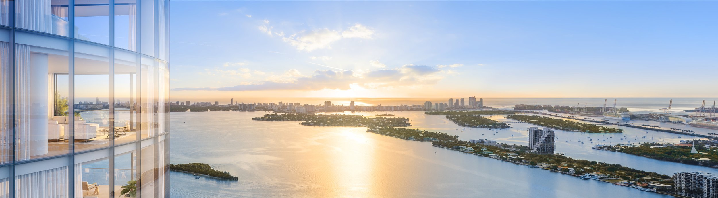
VIZCAYA STATION

Final Rendering for Vizcaya Station

Original aerial backplate image used for photo realistic 3D Rendering.
Why Developers & Architecture Firms Choose Drone Genius
✓ Production-Grade Standards
We deliver broadcast-quality aerials that meet the technical requirements of professional rendering and post-production workflows.
✓ Dual-Operator Precision
Our two-person flight teams enable independent control of aircraft positioning and camera framing, ensuring we capture exactly the angles your project demands.
✓ Seamless Airspace Coordination
We handle all FAA authorizations, including complex Class B airspace operations and flights near airports—keeping your project on schedule.
✓ Decade of Florida Experience
Since we were among the first commercial drone operators in Florida, we understand local permitting, weather patterns, and the specific needs of South Florida's architecture and development community.
✓ Multi-Phase Project Partnership
We build long-term relationships with our clients, providing consistent documentation and flexible scheduling as your project evolves.
Here’s What it Looks Like Having us Handle Your Project
Let's Discuss Your Project
Whether you need backplate capture for an upcoming rendering deadline, multi-phase documentation for a large-scale development, or site survey materials for design iteration, we're here to support your vision with precision aerial services.
Contact Drone Genius:
Primary Service Area: Miami, Fort Lauderdale, Palm Beach, Florida
FAA Certified: Part 107 Licensed & Fully Insured ($5M-$10M)
Typical Response Time: Same-day project consultation
Turnaround: 48-72 hours for deliverables
Technical Deliverables Include:
8K CinemaDNG RAW / ProRes RAW Video
44MP DNG RAW Still Photography
5.1K ProRes 422HQ Footage
Color-Graded Masters
Orthomosaic Mapping & Elevation Data
GPS Metadata & Camera Specifications
Serving:
Architecture Firms | Developers | Visualization Studios | Design Teams | Real Estate Development Firms | Urban Planning Consultants